


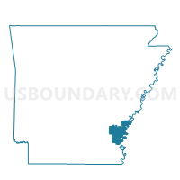
Halley Voting District, Desha County, Arkansas
About
Outline

Summary
| Unique Area Identifier | 526385 |
| Name | Halley Voting District |
| County | Desha County |
| State | Arkansas |
| Area (square miles) | 34.16 |
| Land Area (square miles) | 33.71 |
| Water Area (square miles) | 0.45 |
| % of Land Area | 98.68 |
| % of Water Area | 1.32 |
| Latitude of the Internal Point | 33.57301370 |
| Longtitude of the Internal Point | -91.31578160 |
Maps


Graphs
Select a template below for downloading or customizing gragh for Halley Voting District, Desha County, Arkansas


Neighbors
Neighoring Voting District (by Name) Neighboring Voting District on the Map
- Bowie Rural Voting District, Chicot County, AR
- Bowie Rural Voting District, Desha County, AR
- Clayton Voting District, Desha County, AR
- Franklin Voting District, Desha County, AR
- Mcghee Ward 2, Desha County, AR
Top 10 Neighboring County Subdivision (by Population) Neighboring County Subdivision on the Map
- Bowie township, Desha County, AR (4,213)
- Bowie township, Chicot County, AR (3,233)
- Clayton township, Desha County, AR (575)
- Franklin township, Desha County, AR (417)
- Halley township, Desha County, AR (346)
Top 10 Neighboring Place (by Population) Neighboring Place on the Map
Top 10 Neighboring Unified School District (by Population) Neighboring Unified School District on the Map
Top 10 Neighboring State Legislative District Lower Chamber (by Population) Neighboring State Legislative District Lower Chamber on the Map
Top 10 Neighboring State Legislative District Upper Chamber (by Population) Neighboring State Legislative District Upper Chamber on the Map
Top 10 Neighboring 111th Congressional District (by Population) Neighboring 111th Congressional District on the Map
Top 10 Neighboring Census Tract (by Population) Neighboring Census Tract on the Map
- Census Tract 801, Chicot County, AR (3,595)
- Census Tract 9504, Desha County, AR (3,066)
- Census Tract 9501, Desha County, AR (1,528)